From 4 to 6 February 2026, members of the University of Lille team participated in the 17èmes Rencontres de Théo Quant – Réflexions et pratiques en géographie théorique et quantitative, held at the Maison des sciences humaines et environnementales Claude‑Nicolas Ledoux in Besançon, France. The conference, organised by the Laboratoire ThéMA (UMR 6049‑CNRS, Université Marie et Louis Pasteur), brought together researchers exploring innovative quantitative approaches in geography.
Strategic Choices in Building Cross‑Border Climate Projection Datasets
Gabriel Mazzilli presented the team’s work titled “Strategic choices and compromises in developing cross-border climate projection datasets for the 2050 and 2100 time horizons (Interreg NWE ClimASed project)”.
His contribution highlighted the methodological and strategic decisions involved in designing a prospective dataset on extreme precipitation for ClimASed. The presentation compared several modelling options and addressed challenges related to:
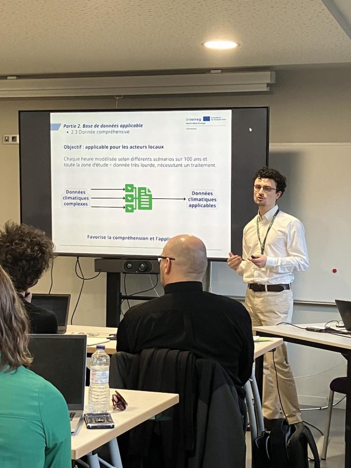
- balancing data availability with spatial and temporal resolution,
- managing uncertainty and cross‑border coverage,
- handling computational demands,
- ensuring representativeness across national boundaries.
These reflections stimulated valuable discussion at the conference and support ClimASed’s ambition to establish a transparent, reproducible framework for future climate‑change analyses across European river basins.
Modelling Soil Erosion Under Climate Change in the Écaillon Catchment
Floriane Peudon presented “Modélisation prospective de l'érosion hydrique des sols dans le cadre du réchauffement climatique : application au bassin versant de l’Écaillon (Hauts‑de‑France, France)”, carried out within the Interreg NWE ClimASed project.
The study focused on the feasibility of modelling future runoff and soil erosion using the WaterSed model (BRGM) in a transboundary research context. The presentation addressed several key aspects:
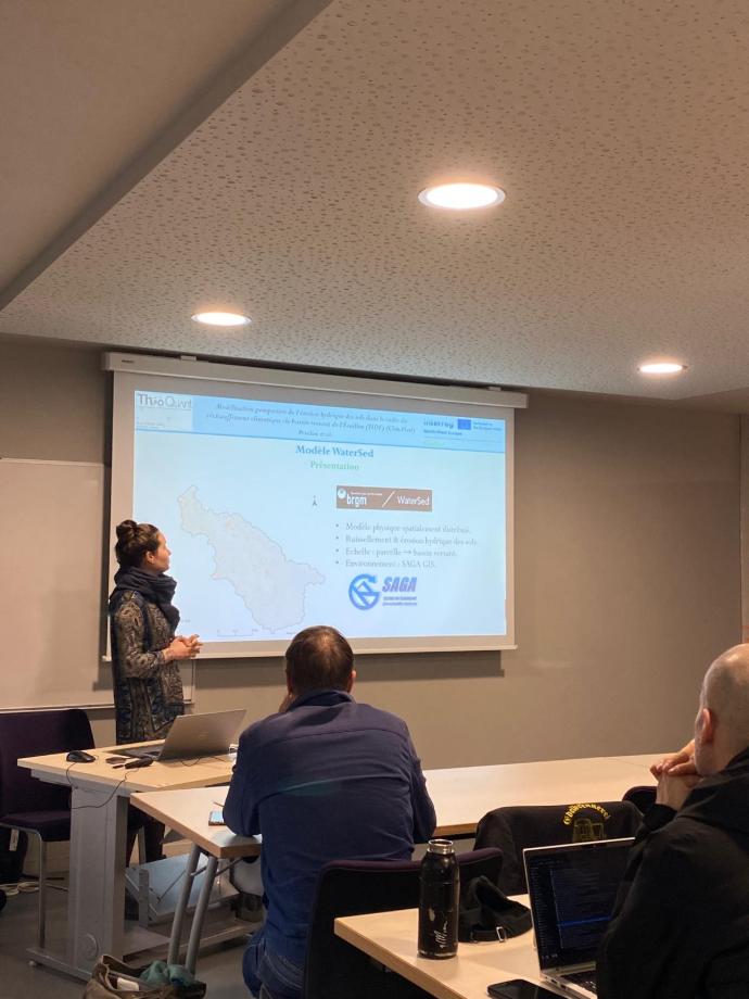
- the geographic data required for current and prospective simulations,
- methodological constraints when integrating cross‑border datasets,
- implications for developing a spatial decision‑support system for local authorities.
The work underlines how climate‑driven changes to precipitation patterns may intensify soil erosion processes and highlights the importance of robust modelling tools for guiding sustainable sediment and soil management in the Scheldt basin.
Strengthening ClimASed’s Scientific Footprint
Both presentations demonstrate ClimASed’s growing contribution to cross‑border climate and sediment research. They showcase the project’s commitment to generating actionable scientific insights for river managers, landowners and other stakeholders.